


At Francisco's, a small mountain meadow above the river, the trail forks in two directions: To the south you can cross the river to its south side and ascend the river canyon to Sliger Mine and the proposed Auburn Dam reservoir take-line boundary trail. The Tevis Cup Ride takes the second option, heading in a westerly direction along the north side of the river. This section of trail winds in and out of tributary stream ravines, past the ruins of gold camps and through shady forests of oak, Ponderosa and Digger Pine.
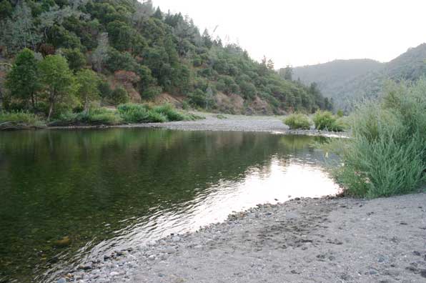
In a few miles the trail, now lined with blackberries and wild grape vines, dips temptingly close to the river along a primitive wagon road built during the gold rush. The trail gently descends to a large sandy beach at Poverty Bar and the river ford to Philadelphia Bar. Here, water levels fluctuate during the summer. Use extreme caution if making this crossing other than on Ride Weekend when the river flows are controlled by reduced outflows from reservoirs upstream.
There is a wide, well-graded road that parallels the Middle Fork, crossing an occasional sand and gravel bar. A word of caution: Mountain bikes are allowed from Maine Bar to the confluence of the North and Middle Fork four miles downstream.
Near Murderer's Bar the trail forks in two directions: You can turn left (southwest) off the dirt road onto a wide trail that climbs to Cave Valley over a former wagon road which once continued on to California's gold discovery site of Coloma. Today, the trail ascends approximately 900 feet to the upper limestone quarry crossing of Highway 49 near Cool, California. The quarry is active at this location; the limestone is used in the sugar refining process.
The alternative route from the junction takes you westward along the route taken by the Tevis Cup Ride. It is a wide, well-graded road leading to the lower portion of the rock quarry, a section which is no longer active.
Next: Lower Quarry Vet Check to Finish Line