


Foresthill is located northeast of Auburn, about 17 miles from I-80 along the Foresthill Divide Road. Foresthill is the last bit of "civilization" that riders encounter before dropping back down into the canyons for the remainder of the Ride. The main business section is a quarter-mile strip of Gold Rush era buildings, complete with the classic square false fronts on their upper stories. .
The Foresthill Vetcheck is held at an old sawmill site just east of the business section. Riders enter the site from Bath Road, a narrow paved turnoff from the Divide Road that winds downhill to where the trail from Michigan Bluff climbs out from the Volcano Creek canyon, joining about a half mile below the mill site.
Foresthill is the most accessible of all the vetchecks where crews are allowed in to meet their riders.Unlike Robinson Flat, the Foresthill mill site has acres of level dirt/gravel parking space for trailer rigs. It is strongly suggested that crews leave their rigs at Foresthill and carpool the rest of the way to the only other crew-accessible vetcheck, Robinson Flat, farther east along the Divide. You are not allowed to drive a rig into Robinson Flat on Ride day. You can park your rig no closer than Sailor Flat, about one mile from the vetcheck. A shuttle bus is available from there. All traffic into Robinson Flat is strictly controlled on Ride Weekend.
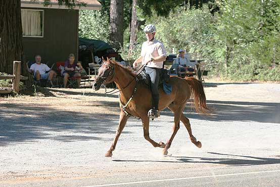
Just as for the residents at Michigan Bluff, Tevis Cup Weekend is a major event for the Foresthill townsfolk. The trail out of the mill site area follows the Divide Road down through the business section. The locals bring chairs out in the afternoon and cheer on the passing riders from their porches and front lawns until well into the evening.
Foresthill is generally the last part of the trail that riders see by daylight. Although some of the front runners make it much farther before nightfall, many riders are happy just to clear Foresthill before dark. (This does not apply to the ride in 2011 due to the change of the event date).
Near the west end of town, the route jogs to the left for one block and continues west on California Street. The pavement ends about 100 yards along, and the route becomes a single-track trail that imediately crosses another paved road, Mosquito Ridge Road. This "California Street Trail" then proceeds into the canyon of the Middle Fork of the American River, the southern flank of the Foresthill Divide.
Next: Francisco's Vet Check

Click for larger view
